Karl's Story
|
By Karl Kaiyala for Northwest Hiker.net
|
|
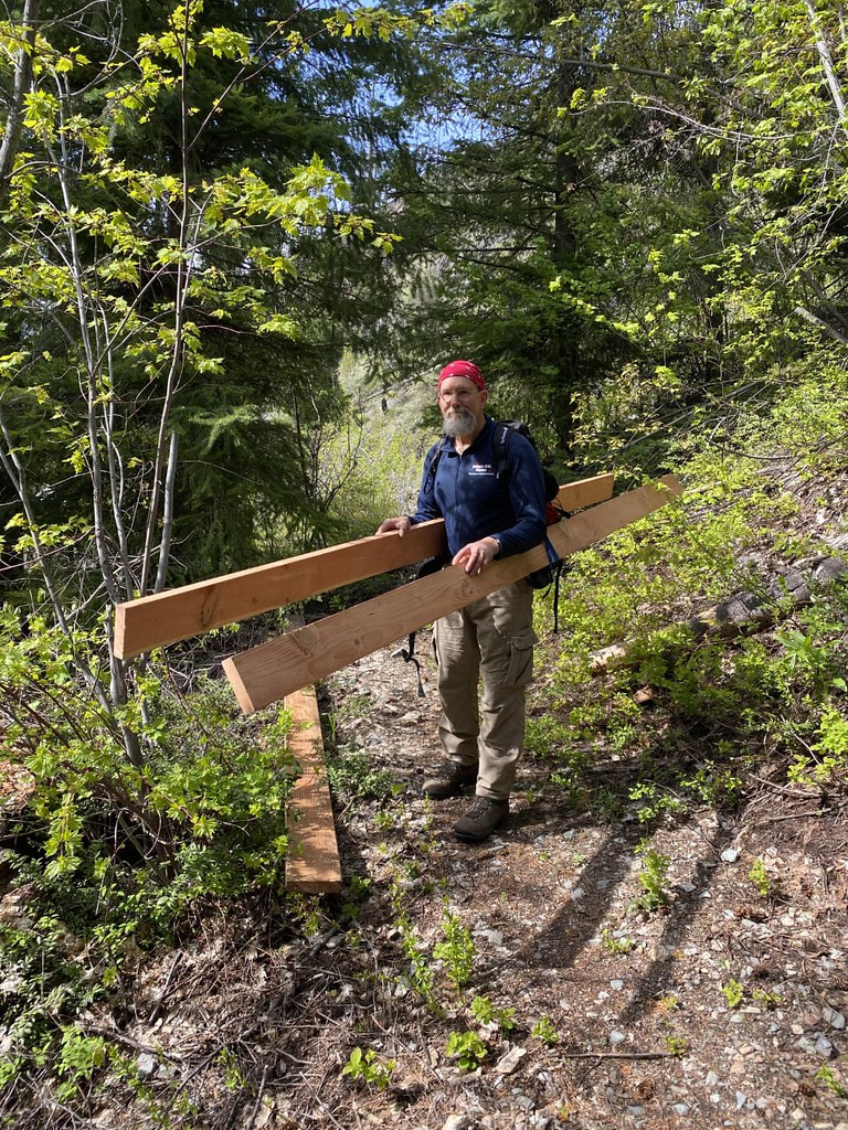
Karl "not a horse" packing in.
The Monument Creek trail #484 begins from the Harts Pass road about seven miles NW of Mazama, courses NE alongside the Lost River, and in about four gently undulating miles reaches Eureka Creek near its confluence with the Lost River at ~2600’elevation. For seekers of a genuine wilderness experience, the realm N of Eureka Creek will "give it to you good and hard" (hat tip to H.L. Mencken). For climbers ticking off Washingon's 100 highest peaks, three (Lake Mountain, Monument Peak and Blackcap Mountain) are situated between the terminus of Eureka Creek and the creek's headwaters near Shellrock Pass; the main challenge, though, is just getting to the part where you start climbing. For hikers, seekers of mythical forest denizens, backcountry fisherman, or for lunacy-adjacent backpack hunters, the trail along Monument Creek NE of Pistol Pass affords a banquet of wilderness and wildlife splendor rich with creatures large and small. This is a place where wild things abound and fortune favors audacity and preparation. Therefore, the long-abandoned section of trail between the Eureka Creek crossing and Shellrock Pass represents a worthy target for reopening. This constitutes a major challenge of the sort that attracts hardy non standard-issue gals and guys afflicted with a penchant for heavy load carrying, extensive crosscut saw work and abundant experience with the phenomenon of "beware what you wish for." Eureka Creek typically runs too swift and deep until late July or August for safe wading, posing for many years a chilly and potentially lethal ford for earlier season hikers. This problem stemmed from flooding on or about May 15, 2008, which washed out the stock bridge. See NWHikers report. Notably, the popular hike to Eureka Creek (and a favorite of local trail runners) is in splendid shape owing in large part to an immense amount of trail work organized largely in recent years by a monumentally determined guy I refer to as The Other Mike. I'm happy to note also that WTA lists this trail as part of their Lost Trails campaign, but so far as I can tell, WTA has not formally sponsored work parties on it since 2012. |
The slide show plays automatically. Click on an image to bring up manual controls.
While Mike is a member of WTA, as are several other crew members associated with this trail and bridge project, it should be emphasized that the work described here owes hugely to The Other Mike, his cadre of non standard-issue trail-fixer friends, and also to the vital support of Dianne and Joe Hofbeck and their Pasayten Wilderness Trust as explained below. Going forward, WTA hotshot crew involvement would be a terrific asset to this project. Well, the footlog bridge part of the project is now a done deal. It's a beauty, designed by retired structural engineer Joe Hofbeck (following FS guidelines), blessed by Magic Trail Elves, and made possible by the Dianne and Joe Hofbeck Pasayten Wilderness Trails Trust. A key part of the work took place Oct 6-14, 2021 when the donor tree was felled by Landon Decker, the Methow Ranger District's very capable trails manager, with the assistance of his crew, and then subsequently peeled with the additional help of a merry band of volunteers. Another essential part of this project happened in Early May, 2022, when The Other Mile milled a Douglas fir log into the planking and rail material for the bridge; the log came from Mike's property and the milling was done via chainsaw, bans and planer. An enormous amount of work went into this process, and the dollar value of the milled would equate to sticker shock. Mike also donated all of the fasteners, and wore out a 32" chainsaw bar. Another vital key to this project was the funding for the bridge itself -- $10,000 worth -- provided by the Dianne and Joe Hofbeck Pasayten Wilderness Trails Trust. The Trust gave the Ten Grand to the Forest Service in the form of a "gift with conditions" to ensure their committment to the bridge project. Completion of the bridge took place September 11-18th 2022. FS packed a metric F-Ton of hand tools to the worksite, which, being within official Wilderness, is off limits to power tool use in accordance with the 1964 Wilderness Act. The remaining lumber was also packed in on horseback. Regarding the steep long-abandoned trail N of the new bridge, Mike and a two other volunteers spent four days working on it in late September, and made it to 5400'. They each carried three gallons of water to their high camp and were hampered by thick smoke from this summer's Pasayten fires. Mike reports that there is a particularly bad section between 4800' and 5100' where the original trail is gone, baby, gone. Users have been going straight up the hill, and it's steep. The trail is reportedly in relatively good shape beyond Mike's high point. The next step is to figure out how to get more help with this project. I did mention that this trail is part of WTA's Lost Trails Initiative, and I'm optimistic that the MV Ranger District and MV Trails Collaborative will remain supportive. |
